Tel : 0-2653-8255 , 085-121-2301 | Import and distribute Trimble & Nikon


Penmap
Hybrid Mobile App for Survey and GIS Data Collection
Penmap is a powerful, yet incredibly straightforward, cloud-connected application for cadastral field surveying and high-accuracy GIS data collection. Whether working on the Windows® or Android™ platform, Penmap is designed to provide both professional surveyors and field workers with a reliable and complete data collection application.
Penmap is a powerful, yet incredibly straightforward, cloud-connected application for cadastral field surveying and high-accuracy GIS data collection. Whether working on the Windows® or Android™ platform, Penmap is designed to provide both professional surveyors and field workers with a reliable and complete data collection application.
Features
- Core survey functionality and high-accuracy GIS data collection
- Powerful but straightforward operations
- Intuitive interface using your own Android device
- Supports Trimble Catalyst software-based GNSS receiver for on-demand precise positioning
- Compatible with existing Trimble GNSS R-Series receivers
0บทวิจารณ์
-
ยังไม่มีความคิดเห็นสำหรับสินค้าชิ้นนี้
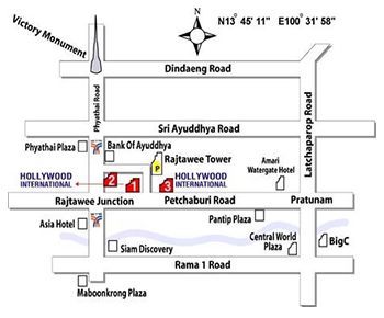
Hollywood International Ltd.
Survey Department
501/4-8 Phetburi Road, Rajtawee, Bangkok 10400
Mobile. : 085-121-2301
Tel. :0-2653-8255, 0-2653-8556 (30 Line)
Fax : 0-2653-9542
Website : www.geohtt.com
E-mail : sv@hollywood.co.th
501/4-8 Phetburi Road, Rajtawee, Bangkok 10400
Mobile. : 085-121-2301
Tel. :0-2653-8255, 0-2653-8556 (30 Line)
Fax : 0-2653-9542
Website : www.geohtt.com
E-mail : sv@hollywood.co.th
Map
Visitor
Copyright © 2023 Hollywood International Ltd. All rights reserved.Design by FINEX DESIGN